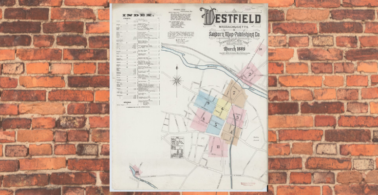
Have you tried to trace the genealogy of your house? In this multi-part series, we will explore how to use local history resources at the library to write the genealogy of your house here in Westfield. In part one of this series, we focused on some of the best resources to consult first when you’re researching the history of your home: our collection of directories, street, and tax lists. But what if you can’t find your house within those resources? That’s where Sanborn Insurance Maps can help.
Sanborn Insurance Maps are a fantastic set of resources because they were created to convey a lot of information about a city or town. Originally created by the Sanborn Map Company, these fire insurance maps documented urbanization, showing just how an area changed over time. When you’re researching your home, but can’t locate it in a directory or street list because house numbers have changed, or street names have changed, it’s a good idea to check our collection of Sanborn Insurance maps.
The Westfield Athenaeum holds Sanborn Insurance Maps of Westfield for the following years: 1884, 1889, 1895, 1900, 1905, 1910, 1917, 1924, and 1947. Inspecting one of these maps can not only tell you how the area around your home has changed, it can sometimes tell you who lived in your house, what their profession was, and even what the structure looked like. There’s a lot more that these maps can show, and for a full guide, I highly recommend visiting the Library of Congress’s searchable database of Sanborn Insurance Maps, which includes a helpful explanation of how to read the keys and colors used in the maps.
Have questions about using Sanborn Insurance Maps? Feel free to come to the Reference desk anytime and we’ll be happy to help!
–Kim L. Pereira, Local History Librarian
Resources: https://www.loc.gov/collections/sanborn-maps/about-this-collection/
Image credit: (1889) Sanborn Fire Insurance Map from Westfield, Hampden County, Massachusetts. Sanborn Map Company, Mar. [Map] Retrieved from the Library of Congress, https://www.loc.gov/item/sanborn03883_002/.


